
Photogrammetry: Art? Science? Part 1
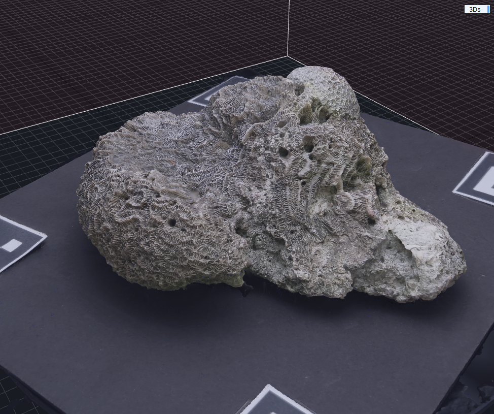
A 3D reconstruction I made, of a Fossil coral specimen, 2025
A New Dimension
I’ll let you be the judge…but Photogrammetry is an interdisciplinary art and science!
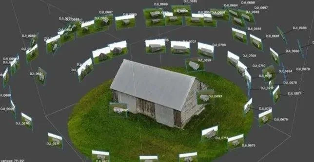
An Orthomosaic, made from overlapping drone photos
To put it simply…Photogrammetry is the method of extracting accurate 3D measurements and models from overlapping photographs.
It works by detecting shared features in multiple images, then using geometry (triangulation + bundle adjustment) to reconstruct:
3D coordinates
Surfaces (meshes)
Textures
Orthomosaics
Digital elevation/terrain models
The Many Use-Cases
Photogrammetry has endless use-case solutions, such as;
Visual inspections
Digital archival of heritage buildings or artifacts
Preservation of history
Measurement of buildings, or land
Large-scale volumetric calculations
Land/construction surveying
Progress of building projects
3D virtual asset creation
Cartography, and GIS (Geographic Information Systems) data extraction
Mapping
Detecting coastal erosion
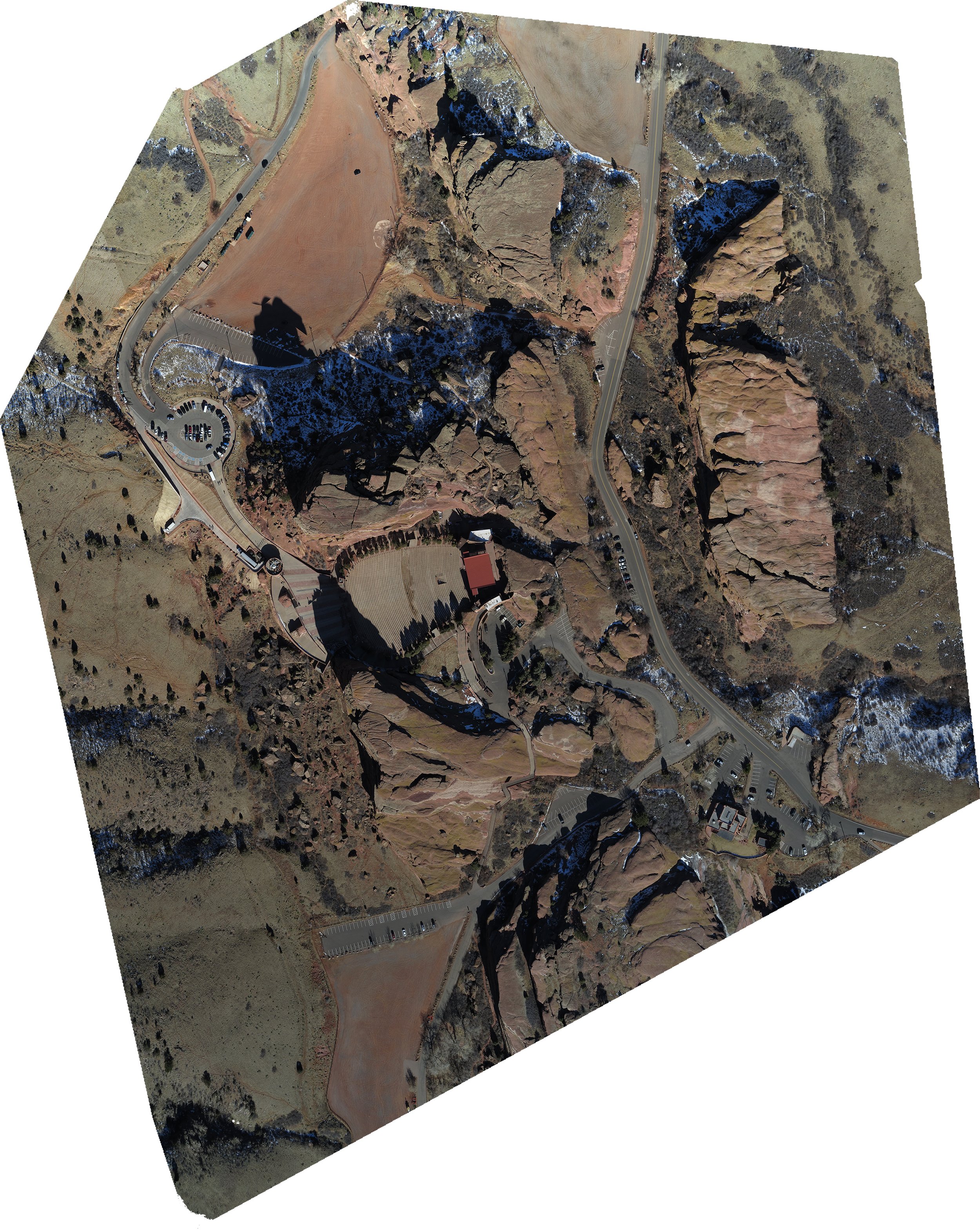
Example of a top-down “Orthomosaic” model, made from hundreds of aerial images (Creative Commons License)
And much much more!
When applied to industrial/commercial uses, the utility and practicality of photogrammetric workflows lets users and teams extract data in a navigable 3D space, and it allows for people to recreate whole environments without having a traditional team use time-consuming methods to have this data.
Some common deliverables include:
Volumetric calculations
Stockpile assessments/reports
Capturing changes in erosion
Digital Elevation Models (DEMs) & Digital Terrain Models (DTMs)
And so much more!
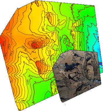
When brought into GIS software, like ArcGIS, or QGIS, these deliverables can then be given a makeover, with elevation contours, shading, labels, and much more valuable data!
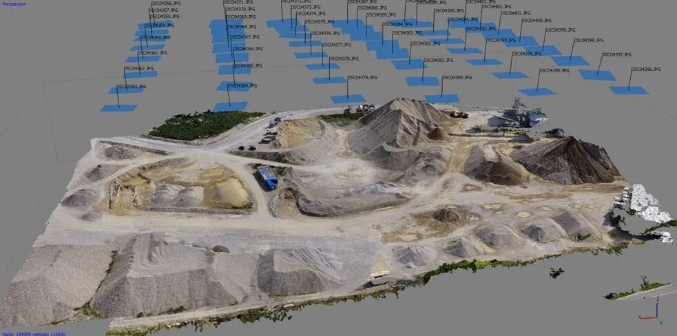
As you can see, this mining site is brought to life, thanks to Photogrammetry. Teams can now measure aggregate stockpiles, measure how much material or debris has been extracted, and so many more benefits!
Even Small-Scale Uses (Teaser)
Photogrammetry isn’t just for extracting information from landscapes, or buildings. A very useful solution for ancient or vintage objects, or historical objects like this fossil of mine, can be digitally archived!
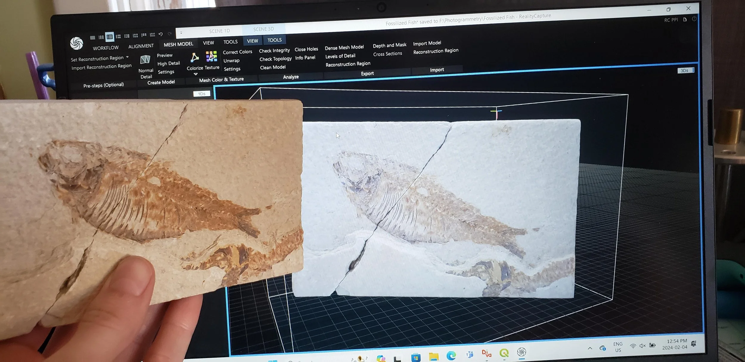
Me, holding my fossil fish, with its digital clone! 2024 (colorized)
In my next article, I will show you how you can do this for free! At least…if you have the right setup and gear! So stay tuned!
Keep an eye out for my Part 2 of this Photogrammetry series!